Biking

Hard

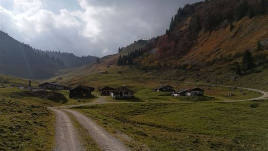
Straubingerhaus / Eggenalm Nr. 248

Mountainbike tour

17,00 km

1102 hm

127 hm

1572 m

Best Time of Year

Jan

Feb

Mar

Apr

May

Jun

Jul

Aug

Sep

Oct

Nov

Dec

Information

Starting point is at the info office in Kössen. From there follow the Hüttfeldstraße to the district Blaik. At the Outdoor Center, turn left and follow the road until you reach a small bridge. Cross the main road and then keep left, turn off directly at the main road onto

Read more ...

Recommended Equipment

Appropriate clothing, sturdy shoes, backpack, rain gear, mobile phone, sun cream, snack and drinks, possibly a camera.

Features & Characteristics

Starting Point

Kössen

End Point

Eggenalm

Map & Elevation Profile

Arrival

Starting point is in the centre of Kössen.

Similar Tour Suggestions

Kaiserwinkl - Challenge Strecke

Medium

Biking

Cycling tour

Road bike tour

Starting Point: Walchsee

End Point: Walchsee

43,50 km

639 hm

625 hm

710 m

Kaiserweis pleasure wheel round Kufstein - Kössen

Medium

Biking

Cycling tour

Starting Point: Infobüro Kössen

End Point: Infobüro Kössen

71,80 km

05:00 h

720 hm

560 hm

700 m

Leukentalradweg Nr. 20

Easy

Biking

Cycling tour

Starting Point: Kössen

End Point: Erpfendorf

13,60 km

01:30 h

120 hm

79 hm

641 m

Mozartradweg Etappe 12, 13

Medium

Biking

Cycling tour

Starting Point: Niederndorf

End Point: Kössen

37,50 km

02:30 h

423 hm

318 hm

759 m

Kaiserwinkl Runde Nr. 15

Medium

Biking

Cycling tour

Starting Point: Dorfzentrum Walchsee

End Point: Dorfzentrum Walchsee

21,80 km

02:30 h

169 hm

171 hm

700 m

Kranzhorn Nr. 16, 314, 334, 333

Medium

Biking

Mountainbike tour

Starting Point: Walchsee

End Point: Walchsee

43,40 km

1366 hm

1371 hm

1237 m

Kössen - Kitzbühel BIKE TRAIL TIROL Etappe: 11

Hard

Biking

Cycling tour

Mountainbike tour

Starting Point: Kössen

End Point: Kitzbühel

56,30 km

06:55 h

1746 hm

1580 hm

1725 m

Medium

Biking

Road bike tour

Starting Point: beliebiger Einstieg

End Point: beliebiger Endpunkt

109,10 km

816 hm

801 hm

701 m