We use cookies for your personalized browsing experience, to personalize content and ads, to provide social media features, and to analyze traffic to our website. We also share information about your use of our website with our social media, advertising and analytics partners. Our partners may combine this information with other data that you have provided to them or that they have collected as part of your use of the Services. (incl. US providers)

Hiking

Easy

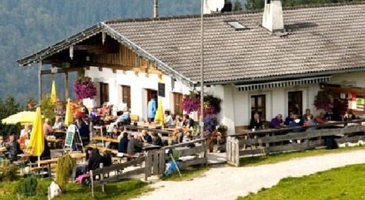
Edernalm

Hiking tour

+1

3,20 km

01:00 h

337 hm

918 m

Best Time of Year

Jan

Feb

Mar

Apr

May

Jun

Jul

Aug

Sep

Oct

Nov

Dec

Information

From the Steinbauer car park in Kössen, walk towards Staffnerhof and after approx. 150m, turn left onto the footpath and follow this as far as Staffnerhof. From Staffnerhof, the route follows up to the Edernalm.

Recommended Equipment

appropriate clothing, proper footwear, backpack, rain protection, possibly hiking poles, mobile phone, sunscreen, snacks and drinks, possibly photo camera

Features & Characteristics

Endurance

Huts & Alpine Pastures

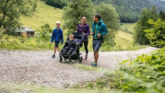
Family-friendly

Yes

Map & Elevation Profile

Arrival

To the village centre of Kössen

Similar Tour Suggestions

Dorfrunde - Kössen

Hiking

Starting Point: Startpunkt Kreisverkehr

End Point: Endpunkt Kreisverkehr

3,90 km

01:00 h

594 m

Schwendt – Aschental Circuit

Medium

Hiking

Winter walking

Hiking tour

Starting Point: Dorfzentrum Schwendt

End Point: Dorfzentrum Schwendt

2,30 km

01:00 h

72 hm

Dorfrunde - Kohlental

Easy

Hiking

Starting Point: Gemeindeamt Schwendt

End Point: Gemeindeamt Schwendt

5,50 km

01:30 h

82 hm

Dorfrunde - Josefstal

Medium

Hiking

Starting Point: Pfarrkirche Walchsee

End Point: Pfarrkirche Walchsee

5,60 km

02:00 h

220 hm

Rund um Kössen

Easy

Hiking

Hiking tour

Starting Point: Sportplatz Kössen

End Point: Sportplatz Kössen

9,40 km

02:30 h

81 hm

82 hm

647 m

Premium hike Quellenweg Schwendt.

Hiking

Hiking tour

+1

Starting Point: Parkplatz nähe Kaiserwinkl Fischteiche

End Point: Parkplatz Nähe Kaiserwinkl Fischteiche

3,10 km

01:00 h

21 hm

14 hm

675 m

Jausenstation Mühlberghof

Easy

Hiking

Winter walking

Hiking tour

+1

Starting Point: Infobüro Kössen

End Point: Jausenstation Mühlbergalm

2,60 km

02:00 h

223 hm

804 m

Glassalm

Easy

Hiking

Hiking tour

Starting Point: Staffenbrücke Kössen

End Point: Staffenbrücke Kössen

7,50 km

02:00 h

260 hm

279 hm

806 m