We use cookies for your personalized browsing experience, to personalize content and ads, to provide social media features, and to analyze traffic to our website. We also share information about your use of our website with our social media, advertising and analytics partners. Our partners may combine this information with other data that you have provided to them or that they have collected as part of your use of the Services. (incl. US providers)

Hiking

Easy

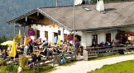
Moosen - Peternhof

Hiking tour

+1

3,10 km

01:30 h

306 hm

798 m

Best Time of Year

Jan

Feb

Mar

Apr

May

Jun

Jul

Aug

Sep

Oct

Nov

Dec

Information

In the village center, at the municipal office, over the Mühlbergweg up to the fork of the road Moosen (not before on the way to the Peternhof). Now the path leads through a forest parcel, past the farm Zeisterer to Weiler Moosen. Continue right, past Hof Eglack to Hotel Peternhof

Read more ...

Recommended Equipment

entsprechende Kleidung, richtiges Schuhwerk, Rucksack, Regenschutz, evtl. Wanderstöcke, Handy, Sonnencreme, Jause (Brotzeit) und Getränke, evtl. Fotokamera

Features & Characteristics

Starting Point

Dorfzentrum Kössen

End Point

Peternhof

Family-friendly

Yes

Map & Elevation Profile

Similar Tour Suggestions

Breitenstein

Medium

Hiking

Hiking tour

Starting Point: Infobüro Walchsee

End Point: Infobüro Walchsee

9,50 km

07:00 h

1224 hm

235 hm

1649 m

Rettenschöss - Wildbichlalm

Medium

Hiking

Winter walking

Hiking tour

+1

Starting Point: Rettenschöss

End Point: Wildbichlalm

7,00 km

02:30 h

370 hm

155 hm

1018 m

Lochner Wasserfall - Burgeralm - Wandberg - Nr. 55B, 44, 54

Medium

Hiking

Hiking tour

Starting Point: Infobüro Walchsee

End Point: Infobüro Walchsee

13,80 km

06:00 h

974 hm

1408 m

Lucknerhof

Medium

Hiking

Winter walking

Hiking tour

Starting Point: Sportplatz Kössen

End Point: Sportplatz Kössen

9,80 km

03:00 h

292 hm

175 hm

720 m

Priener Hütter - Karkopf

Medium

Hiking

Hiking tour

Starting Point: Infobüro Walchsee

End Point: Infobüro Walchsee

18,20 km

06:00 h

1118 hm

1093 hm

1451 m

Schmugglerweg Klobenstein

Medium

Hiking

Hiking tour

+1

Starting Point: Staffenbrücke

End Point: Klobenstein

4,10 km

03:00 h

143 hm

658 m

Closed
Schwendt - Kohlalm

Medium

Hiking

Hiking tour

Starting Point: Parkplatz Kohlalm

End Point: Kohlalm

5,40 km

02:00 h

590 hm

1255 m

Dorfrunde - Rettenschöss

Easy

Hiking

Starting Point: Gemeindeamt Rettenschöss

End Point: Gemeindeamt Rettenschöss

5,60 km

01:30 h

116 hm

667 m