Discover the Kaisergebirge
Multiday hike
The Kaiser Mountain range at the entrance to Tyrol is a fascinating hiking area. Here you will find everything from the cozy hills of the Chiemgau Alps on the north side to the steep slopes of the Kitzbühel Alps on the south side with Mount Wilder Kaiser, which rises abruptly over 2,300 meters into the air. The perfect conditions for a varied multi-day hike, where you will definitely get your money's worth!
You will hike from Kufstein to the Stripsenjochhaus cabin, then to Walchsee and finally to Kössen for 3 days and explore in these 3 stages the picturesque landscape between Mount Wilder Kaiser and Mount Zahmer Kaiser (former Adlerweg stages 90, 91, 92).
Alternatively, you can also start your hike in Kössen and thus make the tour a circular hike. The start of the multi-day hike is very easy with public transport: Kufstein is very well connected by train and can be reached from Kössen in 45 minutes by Regiobus. That way you can leave your car behind without worrying.
Stage 1, Day 1
From Kufstein to the Stripsenjochhaus cabin
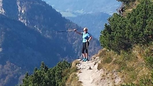
Day 1 - Multiday hike
| Kriterien | Etappe 1, Variante Kufstein | |
|---|---|---|
| Ausgangspunkt: | Kufstein (499 m) | |
| Endpunkt: | Stripsenjochhaus (1.577 m) | |
| Höhenmeter bergauf: | 1.150 m | |
| Höhenmeter bergab: | 50 m | |
| Höchster Punkt: | 1.577 m | |
| Schwierigkeitsgrad: | mittelschwierig (rot) | |
| Wegbeschaffenheit: | Steig, Fahrweg, Steiganlage, Wanderweg | |
| Streckenlänge: | 11 km | |
| Gehzeit: | 6 Std. |
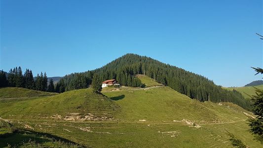
The first stage takes you from the municipality of Kufstein along comfortable footpaths into the nature reserve "Kaisergebirge". You will alternate between shady forest paths and open sections of trail (don't forget the sun protection!). You will also pass several inns, which invite you to a relaxing break and a snack. Continue through two short tunnels to the Anton-Karg-Haus, also called Hinterbärenbad. The house burned down in 1901 and was then rebuilt in Swiss style - stone below, wood on the top - on the initiative of the Kufstein photographer Anton Karg.
Afterwards you walk on a marked footpath through the forest or along the road to the Hans-Berger-Haus. From here, you will hike along the climbing path over many steps through the forest and on the last stage through open terrain up to the Stripsenjochhaus cabin.
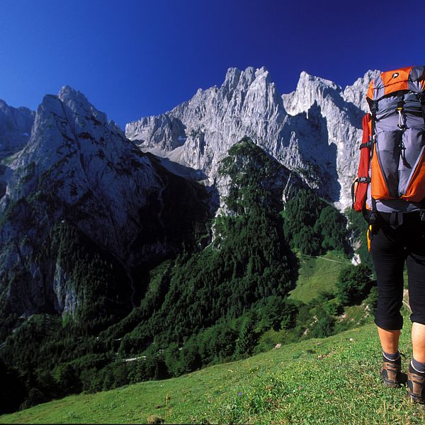
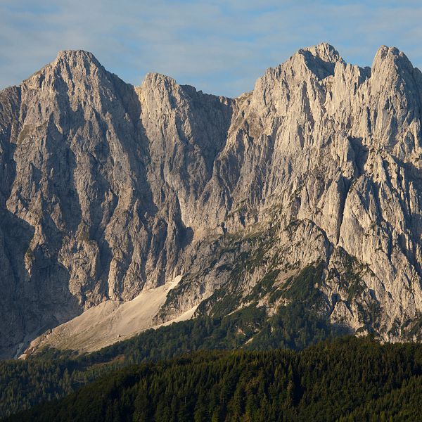
The Stripsenjochhaus is in a unique location at the transition from the Kaiserbachtal to the Kaisertal and at the intersection of the Zahmen and Wilder Kaiser. Here you can enjoy the imposing view to the south of the Kaisergipfel Totenkirchl (2,190m), Fleischbank (2,185m) and Predigtstuhl (2,115m). A look back to the west shows you the Guffertspitze (2.194m), the Pendling (1.653m) and the Bavarian Pre-Alps. In the east you can see Mount Loferer and the Leoganger Steinberge. We definitely recommend you to bring a camera, because impressive vacation photos and (hopefully) clear visibility are guaranteed with this view!
This stage is classified as moderately difficult (red). It only requires stamina and is therefore also suitable for children from about 12 years of age. Please assess your abilities and those of your family members realistically before you consider a multi-day tour and, if in doubt, rather reckon with a longer stage duration and plan enough rest breaks.
Alternative - From Griesenau to the Stripsenjochhaus cabin
Alternatively, you can also choose the route from Griesenau to the Stripsenjoch mountain pass. If you want to save the toll, you can drive by car from Schwendt to Griesenau, park there in front of the toll booth and walk along the Schnackler-Erlebnisweg with Alpine Outdoor Gallery to the Griesner Alm in the Kaiserbachtal. Otherwise, the Griesener Alm can also be reached by car or directly from Kössen/Schwendt by bus.
If you wish, you can also take the 45-minute hike from the Stripsenjochhaus cabin to the summit of Stripsenkopf (1,807m). However, it leads over a very steep path and is marked as difficult (black).
Overnight stays are then in both variants in the Stripsenjochhaus, either in 2-, 4-, 6- or 8-bed rooms or in the dormitory (62 beds available). Please be sure to make a reservation before the start of the tour, either by phone +43 (0)664 355 90 94 or by e-mail at office@stripsenjoch.at.
You will also get food here between 10:30 AM and 07:30 PM – from a hearty Brettljause (Austrian cold cut served on wooden plates) to warm dishes - and you can strengthen yourself with a delicious breakfast before starting the 2nd stage (between 07:00 and 09:00 AM).
Stage 2, Day 2
Stripsenjochhaus cabin over alpine pastures to Walchsee
Day 2 - Multiday hike
| Kriterien | Etappe 2 |
|---|---|
| Ausgangspunkt: | Stripsenjochhaus (1.577 m) |
| Endpunkt: | Walchsee |
| Höhenmeter bergauf: | 500 m |
| Höhenmeter bergab: | 1.400 m |
| Höchster Punkt: | 1.600 m |
| Schwierigkeitsgrad: | mittelschwierig (rot) |
| Wegbeschaffenheit: | Steig, Asphaltweg, Forstweg, Fahrweg, Wanderweg |
| Streckenlänge: | 17 km |
| Gehzeit: | 6 Std. |
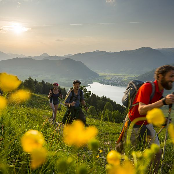
On this part of the tour you will hike past imposing rock faces, picturesque flower meadows and cozy alpine pastures. Here, the simple buildings of the Hochalm, which have been left in their original state, invite you to linger and relax.
From the Hageralm you have the possibility to make a short detour to the Heuberg (1.603m). Here you can enjoy an incomparable view of Lake Walchsee, the Inn Valley and the Chiemgau Alps. Afterwards, your path will lead you over the Lippenalm and then further down the valley to Walchsee. This stage requires endurance and a basic level of surefootedness and is therefore only recommended for young people over 14 years.
At the end of your day's journey, the 25-meter deep and almost one hundred hectare large Walchsee awaits you, which attracts in summer with temperatures between 20 and 24 degrees. Take the chance to cool down or explore one of the many activities that Walchsee has to offer. You can easily book your overnight stay online:
Stage 3, Day 3
From Walchsee via Wandberg and Karalm to Kössen
Day 3 - Multiday hike
| Kriterien | Etappe 3 |
|---|---|
| Ausgangspunkt: | Walchsee (668 m) |
| Endpunkt: | Kössen (589 m) |
| Höhenmeter bergauf: | 1.150 m |
| Höhenmeter bergab: | 1.250 m |
| Höchster Punkt: | 1.661 m |
| Schwierigkeitsgrad: | mittelschwierig (rot) |
| Wegbeschaffenheit: | Steig, Asphaltweg, Forstweg, Wanderweg |
| Streckenlänge: | 20 km |
| Gehzeit: | 8 Std. |
From Walchsee, your path will first lead you through the Schwemm nature reserve. With an area of over 60 hectares, it is the largest preserved moorland in North Tyrol and boasts a large number of rare animal and plant species. If you want to take your time, you can enjoy an impressive panoramic view of the fascinating primeval landscape from a 16-meter-high observation tower.
Afterwards, you will hike across numerous alpine pastures up to the highest point of the tour, the Breitenstein at 1,661 meters. From here you can enjoy a magnificent mountain panorama with views of the Hohe Tauern mountain range with Mount Großglockner (3,798m), the Kitzbüheler Horn (1,996m) and Mount Wilder Kaiser.
The last part of the stage leads you via Karalm and Edernalm down into the valley of Kössen.